Quiz · Medium
Scale calculations, contour lines, grid references, bearings and topographic maps.
The thicker, labelled contour line on a map is called:
A spot height
A hachure
An index contour
A bearing line
Usually every fifth line.
The UTM system divides the world into how many zones?
60
24
12
360
Each zone is 6 degrees wide.
On a 1:50,000 map, 1 cm represents:
50 m
5 km
500 m
50 km
1 cm x 50,000 = 50,000 cm = 500 m.
On a 1:25,000 map, 4 cm represents:
100 m
4 km
10 km
1 km
1 cm = 250 m; 4 cm = 1,000 m.
A path is 6.4 cm long on a 1:25,000 map. Its real length is:
16 km
160 m
1.6 km
6.4 km
6.4 x 25,000 = 160,000 cm = 1.6 km.
Contour lines that are close together show:
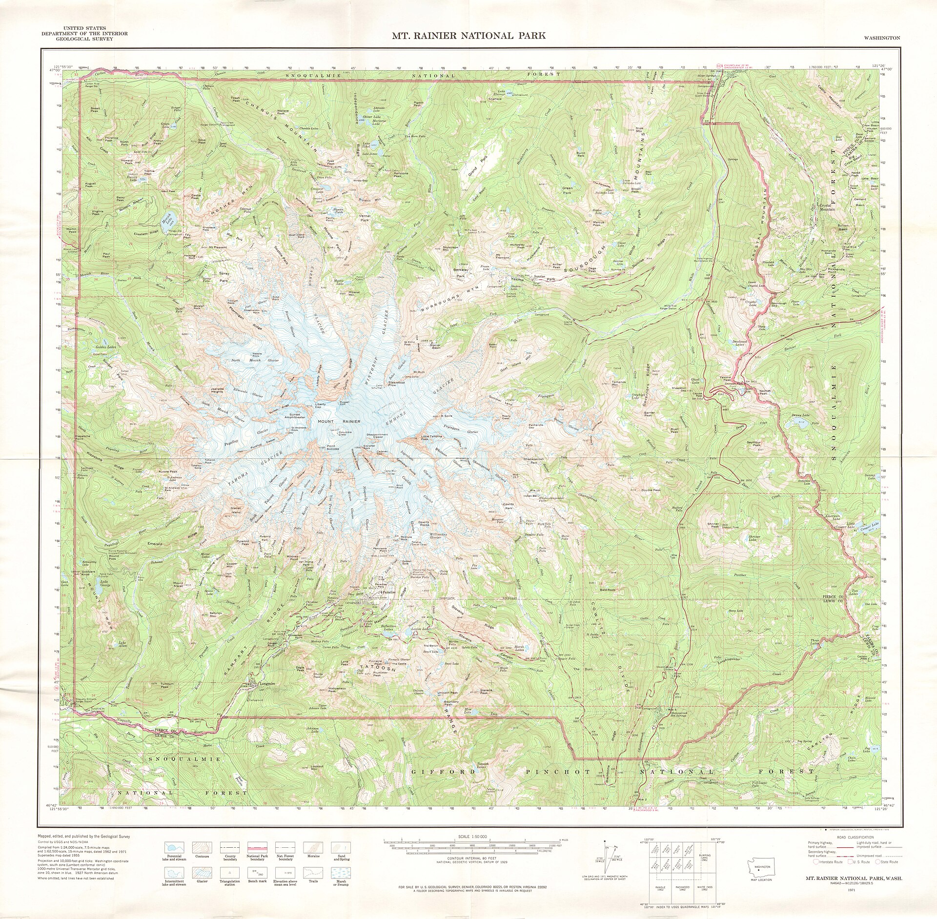
A steep slope
A gentle slope
A flat plain
A lake
The same height change occurs in less distance.
Image: United States Department of the Interior Geological Survey, Public domain, via Wikimedia Commons.
Concentric closed contour rings with rising heights toward the middle show a:
Valley
Lake
Hill
Cliff
A depression would use hachure marks.
V-shaped contours that point uphill usually show a:
Valley
Ridge
Cliff
Summit
A ridge has V-shapes pointing downhill.
A rise of 200 m over 4 km is a gradient of:
1 in 2
1 in 20
1 in 200
1 in 4
4,000 divided by 200 = 20.
In a grid reference, which number comes first?
Northings
Altitude
Scale
Eastings
'Along the corridor, then up the stairs.'
A six-figure grid reference locates a place to within:
100 m
1 km
10 km
1 m
A four-figure reference gives a 1 km square.
A bearing is measured:
Counterclockwise from north
Clockwise from east
From south
Clockwise from north
The bearing of east is 090 degrees.
The bearing of south-west is:
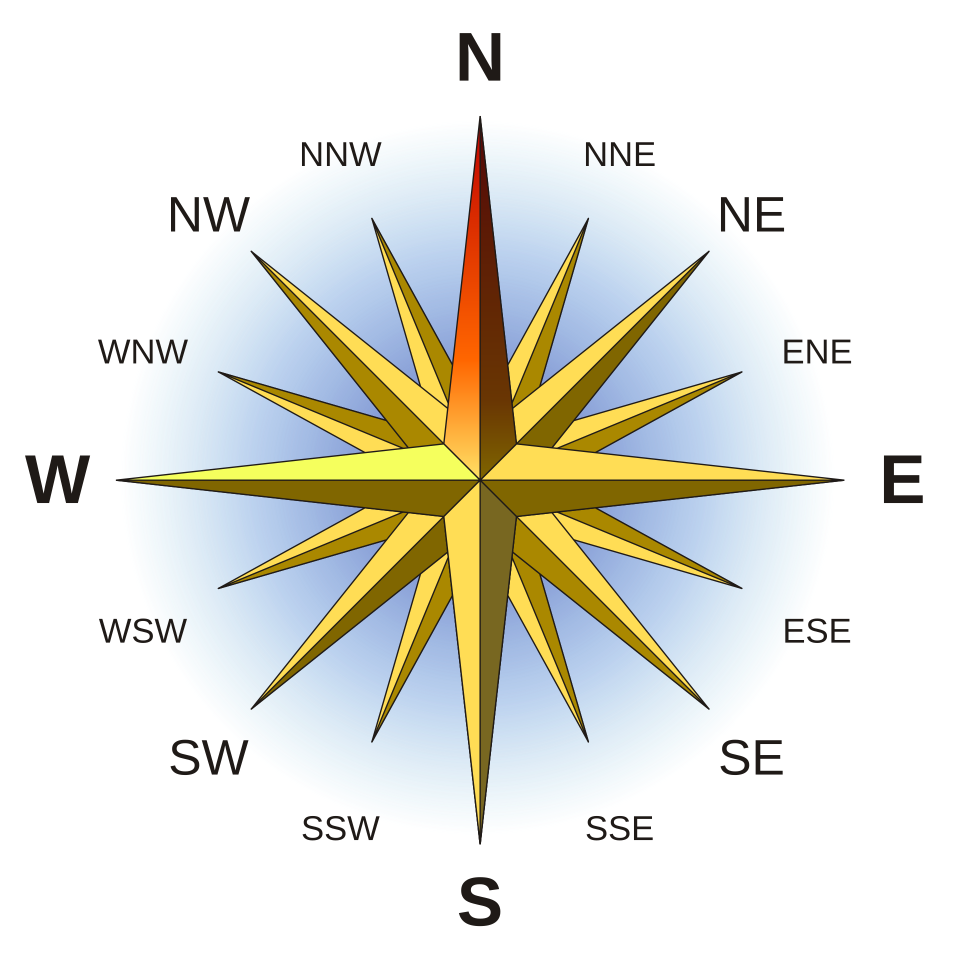
225 degrees
135 degrees
315 degrees
180 degrees
South is 180 and west is 270.
Image: Serg!o, CC BY-SA 3.0, via Wikimedia Commons.
The angle between true north and magnetic north is called:
Magnetic declination
Bearing
Gradient
Azimuth
It varies with location and changes over time.
A 4 cm x 5 cm map area at 1:100,000 represents a real area of:
20 km2
2 km2
200 km2
20 m2
Each cm is 1 km, so 4 km x 5 km.
Which is the larger scale?
1:100,000
1:10,000
1:1,000,000
They are all the same
A smaller denominator means a larger scale.
What does a map legend do?
Shows north
Gives the title
Shows the scale only
Explains symbols and colours
It is also called the key.
Five miles on this bar scale is about:
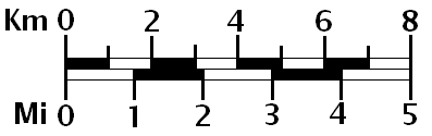
5 km
3 km
16 km
8 km
1 mile is about 1.6 km.
Image: Anna Frodesiak, CC0, via Wikimedia Commons.
A scale of 1:1,000,000 would be best for:
A hike
A building plan
A garden
A regional overview
It is a small-scale map.
