Quiz · Medium
Coordinates, hemispheres, the Prime Meridian, time zones and the International Date Line.
Lines of latitude are also known as:
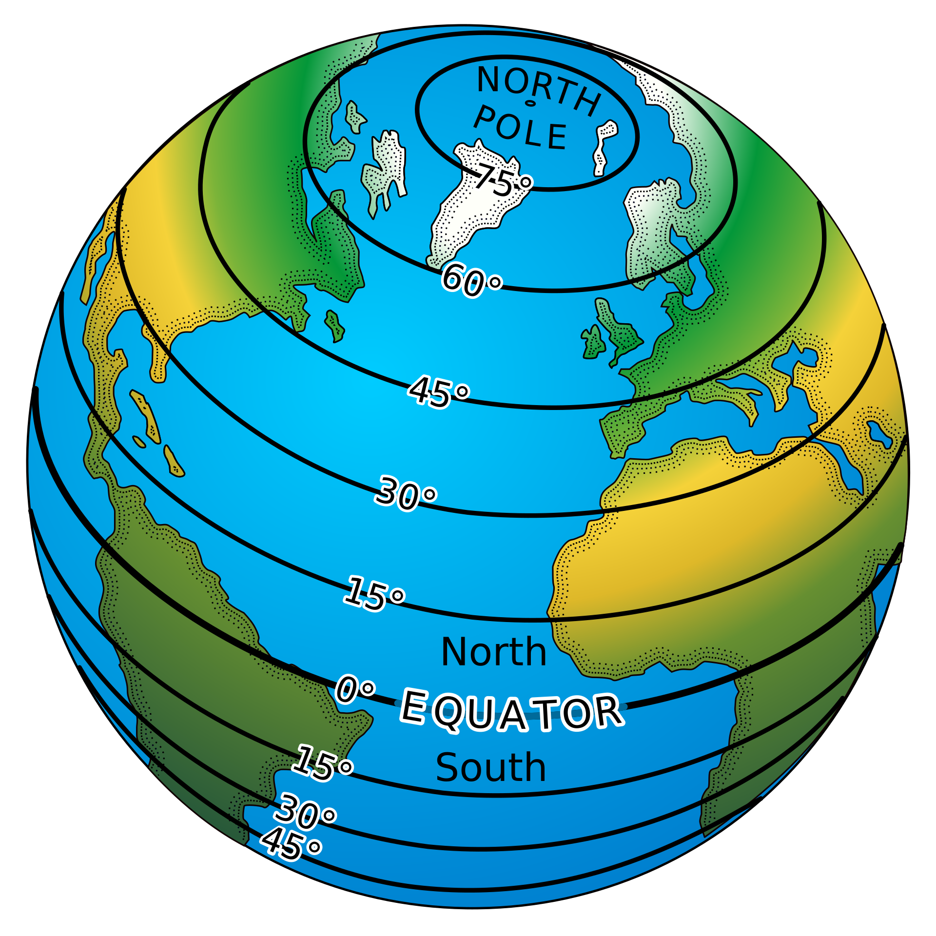
Meridians
Great circles only
Isobars
Parallels
They run east-west, parallel to the Equator.
Image: source: Pearson Scott Foresman, donated to the Wikimedia Foundation, Public domain, via Wikimedia Commons.
Lines of longitude are also known as:
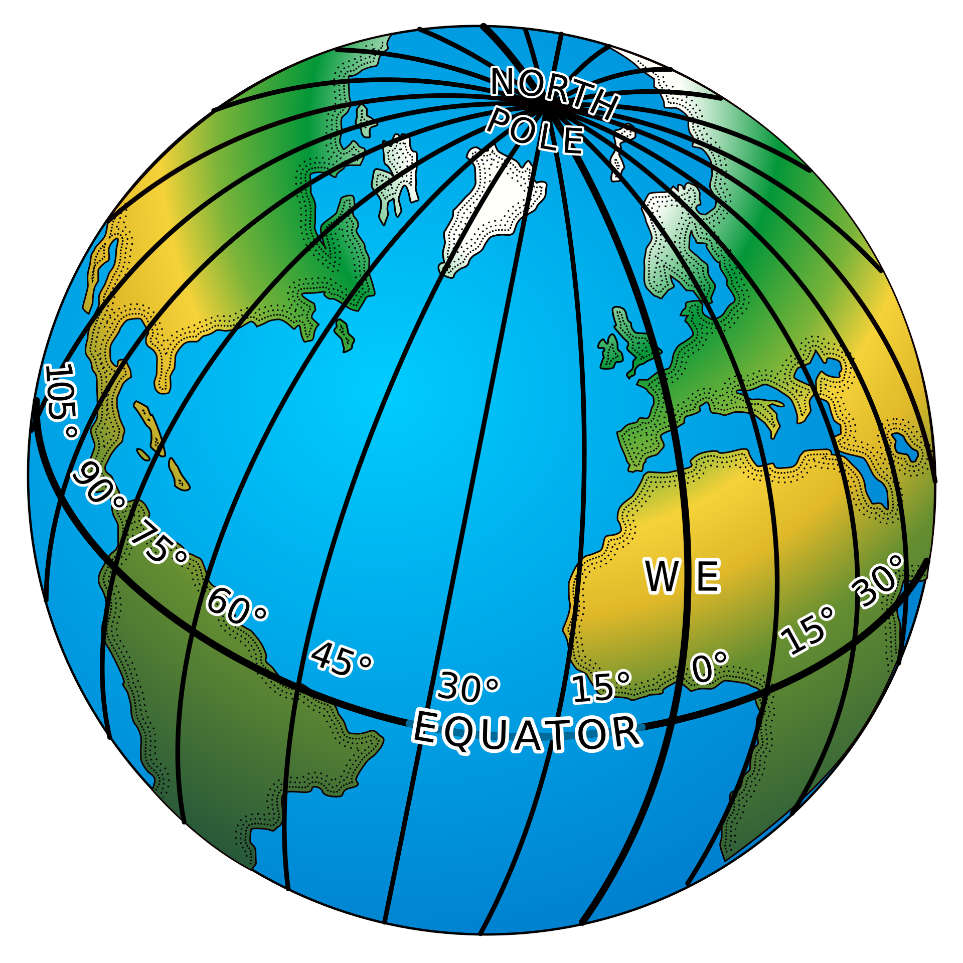
Meridians
Parallels
Tropics
Isotherms
They run from pole to pole.
Image: Jahobr, CC0, via Wikimedia Commons.
What is the latitude of the Equator?
90 degrees
23.4 degrees
66.5 degrees
0 degrees
The poles are at 90 degrees N and S.
The Prime Meridian passes through which city?
Paris
Washington, D.C.
Greenwich, London
Cairo
It was chosen at the 1884 International Meridian Conference.
One degree of latitude is about:
11 km
1,111 km
40 km
111 km
Longitude degrees shrink toward the poles.
The antipode of a point is:
The point on the Equator below it
The point diametrically opposite on Earth
Its mirror image across the Prime Meridian
The nearest pole
Most land has ocean for its antipode.
The time difference between two places 30 degrees of longitude apart is about:
2 hours
30 minutes
30 hours
1 hour
Earth rotates 15 degrees per hour.
A city at 75 degrees W is about how many hours behind UTC in solar time?
15 hours
7.5 hours
5 hours
1 hour
75 divided by 15 is 5.
If it is 12:00 UTC, what time is it in Tokyo (UTC+9)?
9:00 pm
3:00 am
9:00 am
12:00 pm
Add 9 hours.
Which major city lies at about 40.7 degrees N, 74.0 degrees W?
London
Beijing
Sydney
New York
The negative longitude means west.
Which capital lies almost on the Equator in the Andes, at about 0.2 degrees S?
Lima
Quito
Bogota
Nairobi
Ecuador is named for the equator.
Which instrument's invention helped solve the longitude problem at sea?
The marine chronometer
The sextant alone
The telescope
The barometer
John Harrison's H4 was tested in 1761-62.
The International Date Line follows roughly which meridian?
0 degrees
180 degrees
90 degrees E
23.5 degrees
It zigzags to avoid splitting countries.
Which country uses a single time zone (UTC+8) though it spans about five?
Russia
Brazil
India
China
Russia uses 11 zones; India uses one at UTC+5:30.
Which of these is NOT a hemisphere dividing line?
The Equator
Tropic of Cancer
The Prime Meridian
The 180th meridian
The tropics mark overhead-sun limits, not hemispheres.
40 degrees 30 minutes in decimal degrees is:
40.3 degrees
40.05 degrees
40.5 degrees
41 degrees
30 minutes is half a degree.
At 60 degrees latitude, one degree of longitude is about:
111 km
27 km
222 km
55 km
111 x cos(60 degrees) = 55.5 km.
A nautical mile equals how many metres?
1,000
1,609
2,000
1,852
It is one minute of latitude.
Daylight saving time is usually not used:
In Europe
In the United States
In New Zealand
Near the equator
Day length hardly varies there.
