Quiz · Medium
Medieval maps, Waldseemuller, Snow's cholera map, GPS, GIS and remote sensing.
In medieval T-O maps, which direction was at the top?
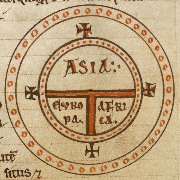
North
South
West
East
This is the origin of the word 'orient'.
Image: Unknown, Public domain, via Wikimedia Commons.
Web Mercator is criticised because it:
Shows Earth as flat
Makes high-latitude countries look much bigger than they are
Has no scale
Cannot show cities
It is still popular because it keeps local shapes correct.
The Hereford Mappa Mundi has which city at its centre?
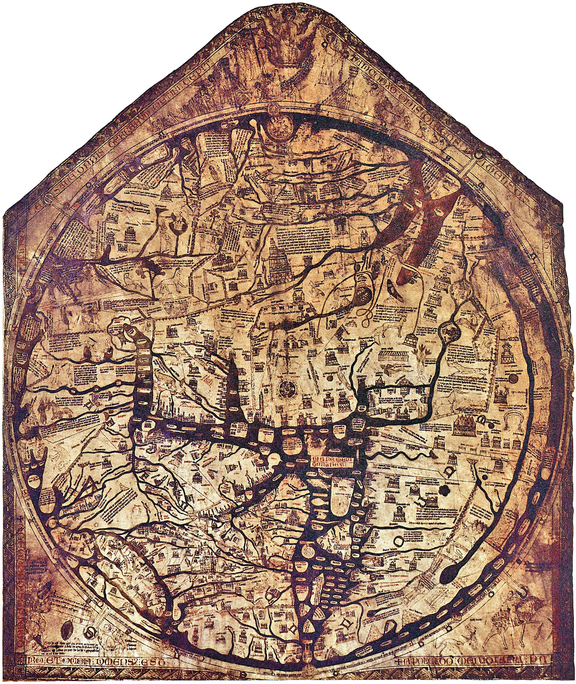
Jerusalem
Rome
Constantinople
Alexandria
It dates to about 1300.
Image: Richard of Haldingham, Public domain, via Wikimedia Commons.
Which ancient Greek scholar wrote Geography and listed places by coordinates?
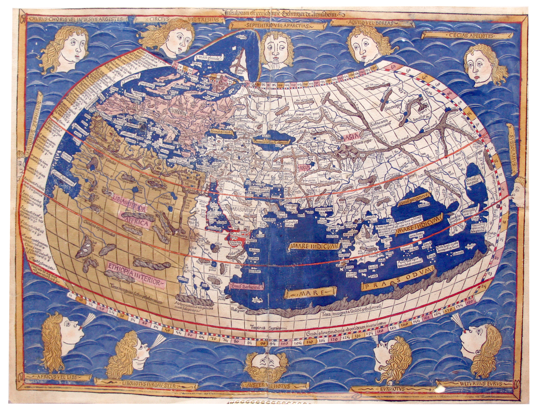
Ptolemy
Herodotus
Strabo
Pythagoras
The work was influential again in the 1400s.
Image: Nicolaus Germanus (cartographer), Johannes Schnitzer (engraver), Public domain, via Wikimedia Commons.
Which 1507 map first used the name 'America'?
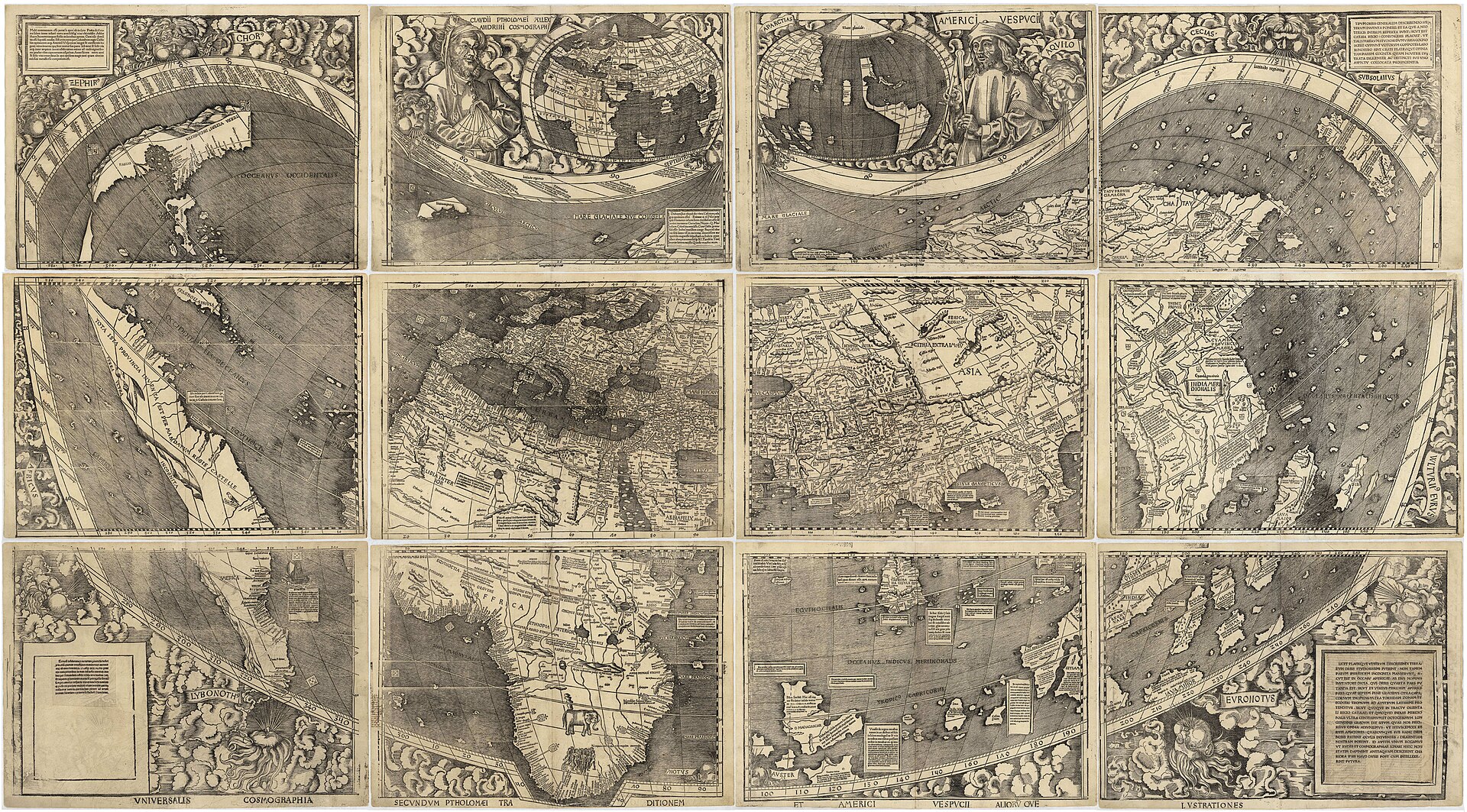
Mercator's world map
The Piri Reis map
Waldseemuller's world map
The Hereford Mappa Mundi
It honoured Amerigo Vespucci.
Image: Martin Waldseemüller, Public domain, via Wikimedia Commons.
Who produced the cylindrical projection for navigation in 1569?
Gerardus Mercator
Arno Peters
Arthur Robinson
Oswald Winkel
It is still the basis of web maps.
What did John Snow's 1854 map of London suggest?
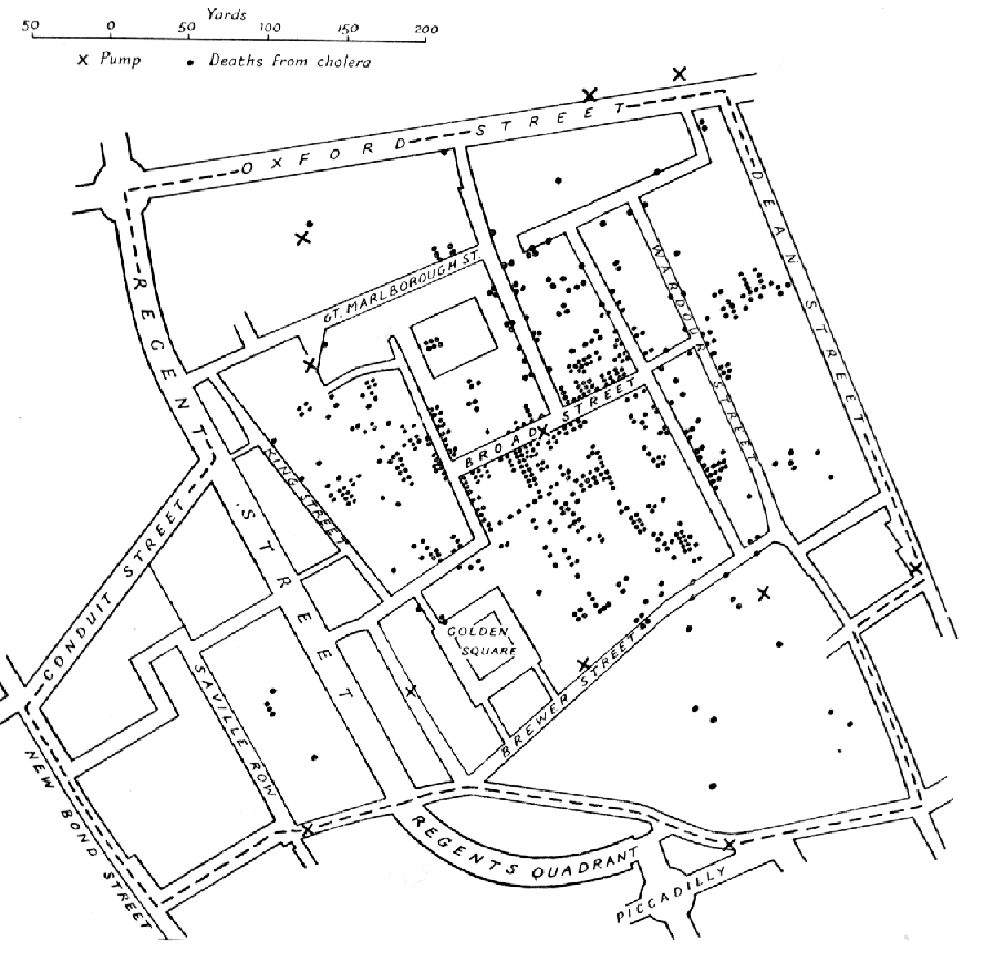
Cholera came from bad air
Cholera was spread by contaminated water from a pump
Cholera came from rats
Cholera came from the Thames mist
The cases clustered around the Broad Street pump.
Image: after John Snow, Public domain, via Wikimedia Commons.
The Global Positioning System needs signals from at least how many satellites to find a position?
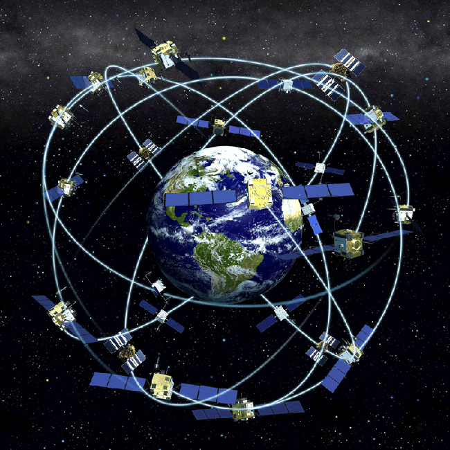
Four
One
Two
Ten
Three for position, one to correct the clock.
Image: U.S. Govt Source, Public domain, via Wikimedia Commons.
GPS satellites orbit at roughly what altitude?
400 km
20,000 km
2,000 km
36,000 km
Geostationary satellites orbit at about 36,000 km.
Which is a European satellite navigation system?
GLONASS
BeiDou
Galileo
NavIC
GLONASS is Russian and BeiDou is Chinese.
In GIS, a raster dataset is made of:
Points, lines and polygons
A grid of cells
Hand-drawn lines
Paper sheets
Satellite images are raster data.
In GIS, roads and rivers are usually stored as:
Vector lines
Raster cells
Photographs
Text files
Cities are often points; countries are polygons.
Landsat, the longest-running satellite imaging programme, began in:
1950
1990
2005
1972
Landsat 1 launched in July 1972.
A satellite sensor that sends its own signal, such as radar, is called:
Passive
Spectral
Temporal
Active
Passive sensors record reflected sunlight.
NDVI is used to monitor:
Vegetation health
Ocean depth
Air pressure
City growth
Healthy plants reflect more near-infrared light.
OpenStreetMap is:
A government mapping agency
A GPS satellite system
A paper atlas
A free, editable world map built by volunteers
It was started in 2004.
Which of these was the first to use the word 'atlas' for a book of maps?
Ptolemy
Piri Reis
Waldseemuller
Gerardus Mercator
His atlas appeared in 1595, after his death.
A Digital Elevation Model stores:
Street names
Ground height in a raster grid
Population
Weather forecasts
It is used for slope and flood analysis.
Geocoding converts:
Addresses into coordinates
Coordinates into time zones
Maps into photographs
Rivers into roads
Reverse geocoding goes the other way.
Piri Reis was an admiral in which empire?
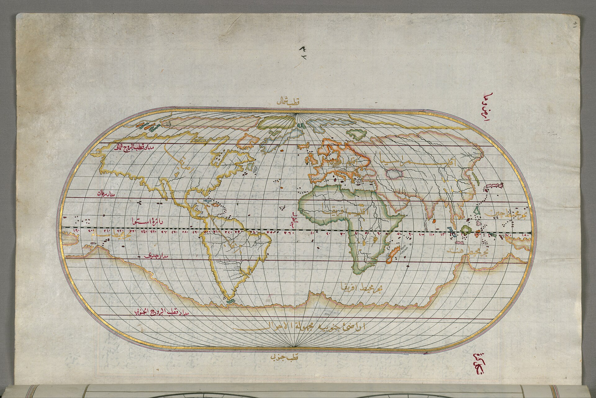
Spanish
Portuguese
Mongol
Ottoman
His maps drew on many earlier sources.
Image: Piri Reis, Public domain, via Wikimedia Commons.
