Quiz · Medium
Mercator, Gall-Peters, Robinson, Winkel tripel, thematic maps and map distortion.
Why does every flat map distort Earth?
Maps are drawn badly
Earth is not round
Cartographers disagree
A sphere cannot be flattened without distortion
Every projection distorts at least one of area, shape, distance or direction.
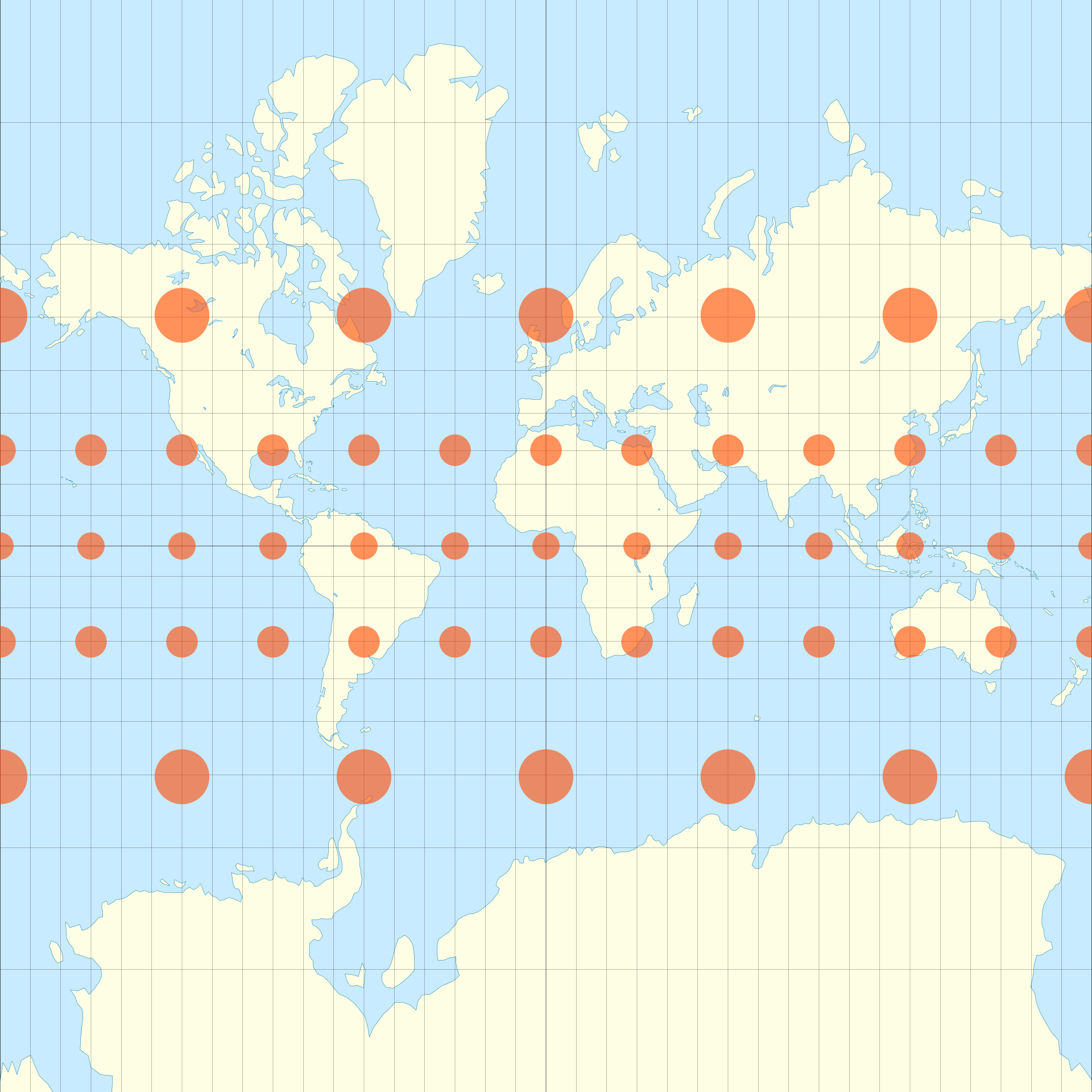
Which projection preserves shapes and angles but greatly exaggerates the size of regions near the poles?
Gall-Peters
Mercator
Equal Earth
Robinson
This is why Greenland looks as large as Africa.
Image: Justin Kunimune, CC BY-SA 4.0, via Wikimedia Commons.
On a Mercator map, a straight line is a:
Rhumb line (constant compass bearing)
Great circle
Meridian
Contour
This is why it was used for navigation.
Which projection keeps area correct but distorts shape, making Africa look tall and narrow?
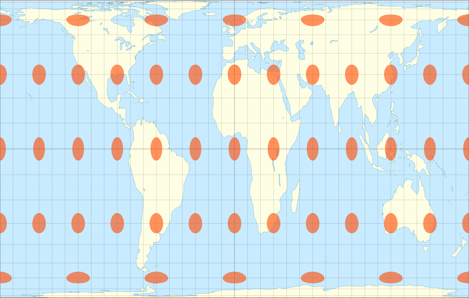
Gall-Peters
Mercator
Azimuthal equidistant
Dymaxion
It is an equal-area cylindrical projection.
Image: Justin Kunimune, CC BY-SA 4.0, via Wikimedia Commons.
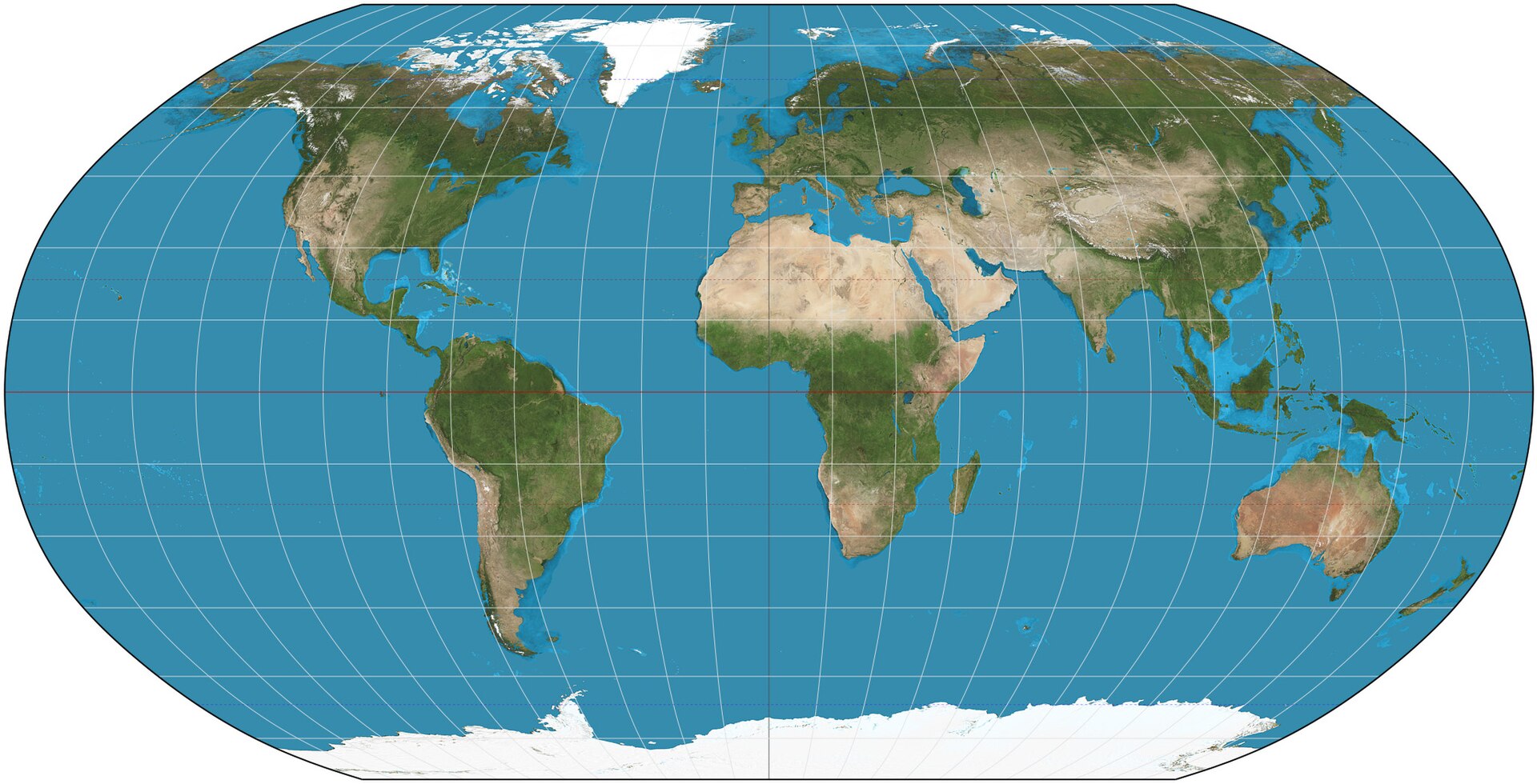
The Robinson projection is an example of a:
Conformal projection
Compromise projection
Equal-area projection
Planar projection
It balances different kinds of distortion.
Image: Strebe, CC BY-SA 3.0, via Wikimedia Commons.
Which projection replaced Robinson in National Geographic's world maps in 1998?
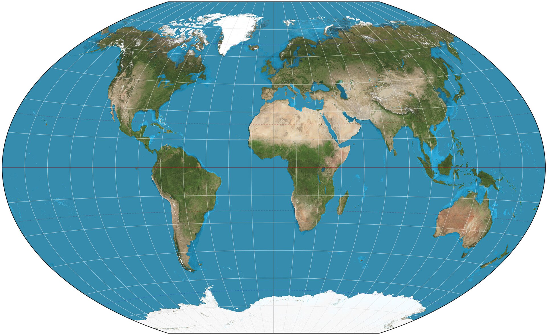
Winkel tripel
Mercator
Gall-Peters
Equal Earth
Oswald Winkel designed it in 1921.
Image: Strebe, Public domain, via Wikimedia Commons.
Which projection shows true distances and directions from its centre point?
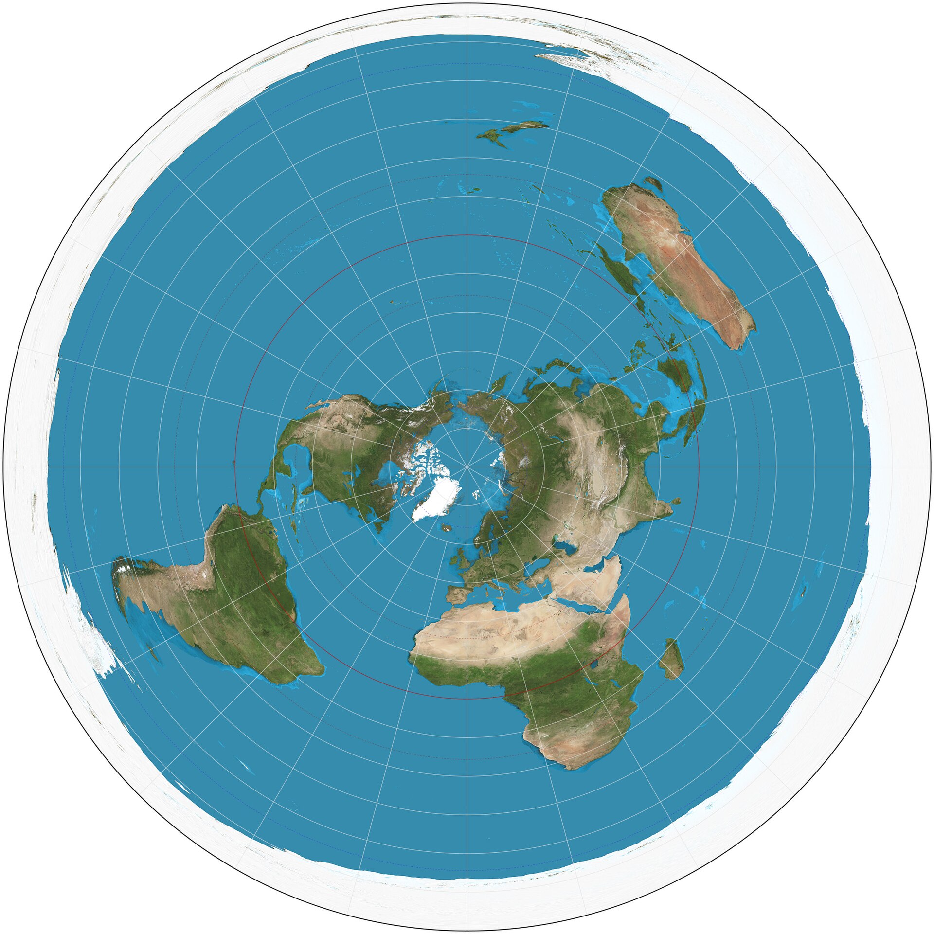
Mercator
Robinson
Gall-Peters
Azimuthal equidistant
The UN emblem uses a version centred on the North Pole.
Image: Strebe, CC BY-SA 3.0, via Wikimedia Commons.
Buckminster Fuller's Dymaxion map is based on:
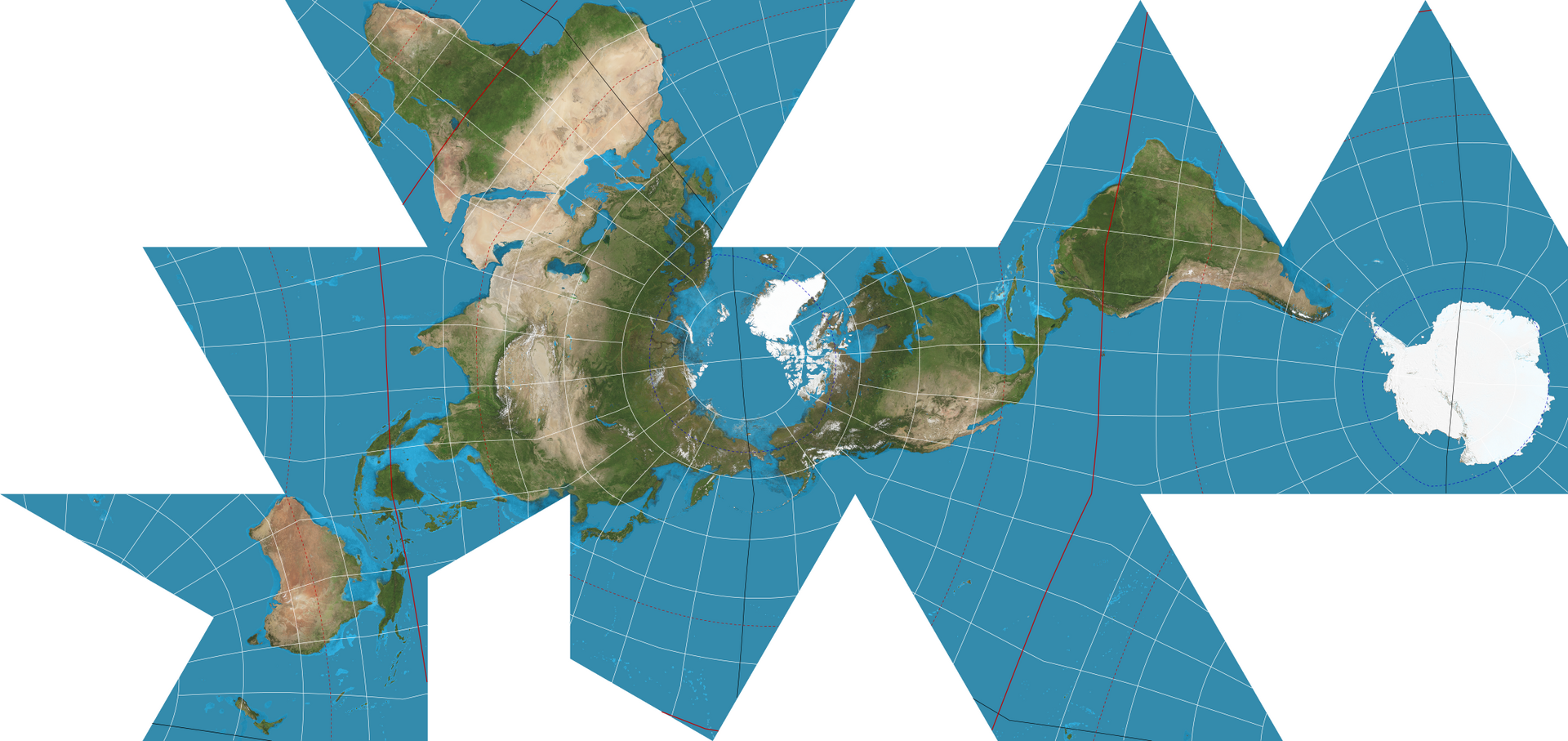
An unfolded icosahedron
A cylinder
A cone
A cube
It has little distortion and no 'up' or 'down'.
Image: Justin Kunimune, Public domain, via Wikimedia Commons.
Which map type uses shaded areas, best when based on rates or densities rather than raw totals?
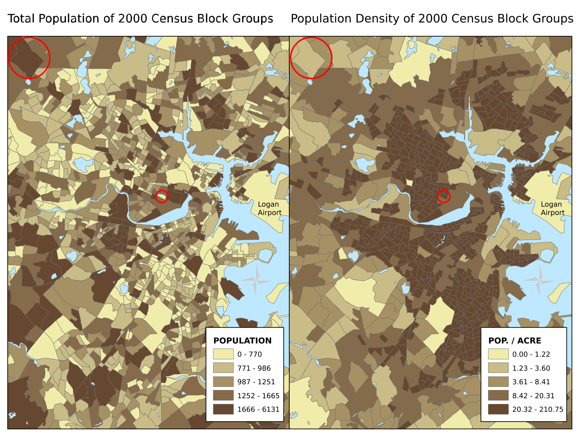
Flow map
Cartogram
Isoline map
Choropleth map
Raw totals mislead because large areas have large totals.
Image: Belg4mit, Public domain, via Wikimedia Commons.
Lines on a map that join places of equal air pressure are called:
Isobars
Isotherms
Contours
Isohyets
Isotherms are lines of equal temperature.
A map in which each country's size is proportional to its population is a:
Cartogram
Choropleth map
Topographic map
Flow map
It sacrifices accuracy of shape to show a statistic.
Charles Minard's famous 1869 map shows:
Cholera deaths in London
Napoleon's Russian campaign, with a line that thins as the army shrinks
The Atlantic trade routes
World time zones
It is a classic flow map.
The line at about 23 degrees 26 minutes north is called the:
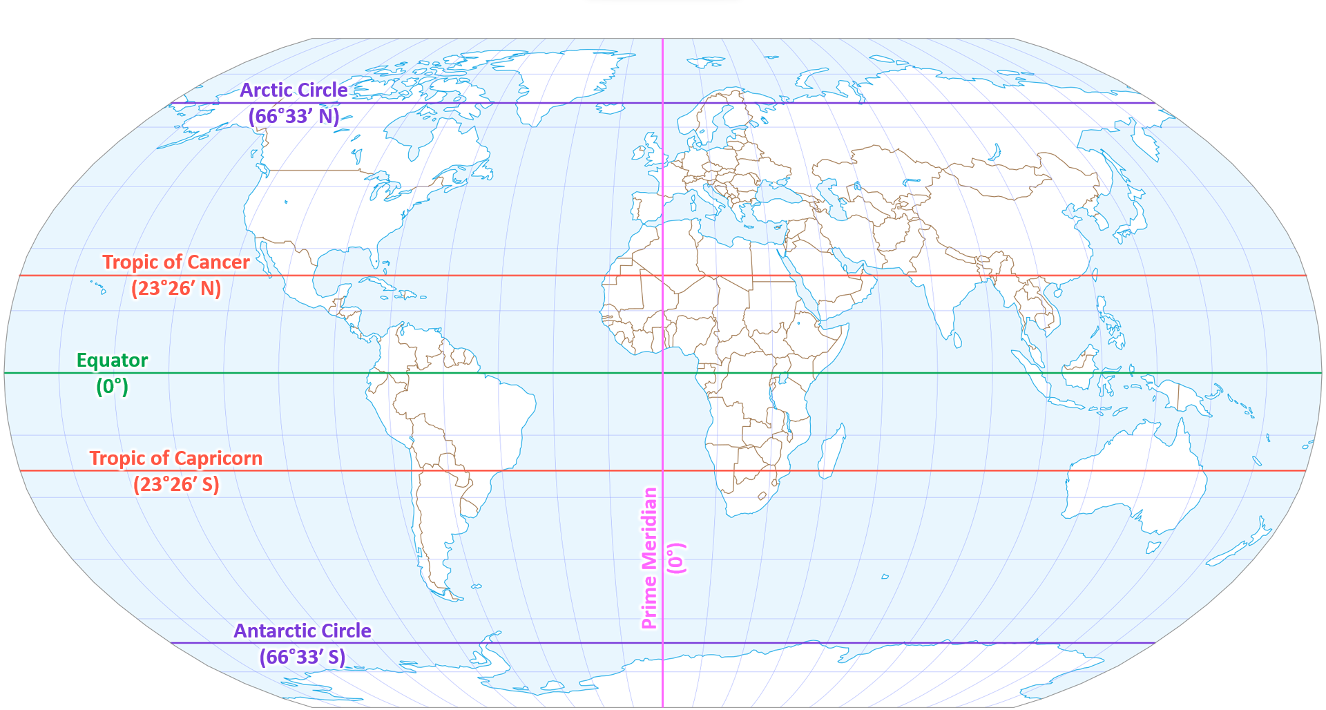
Tropic of Cancer
Tropic of Capricorn
Arctic Circle
Equator
It is where the Sun is overhead at the June solstice.
Image: PJsg1011, CC BY-SA 4.0, via Wikimedia Commons.
A large-scale map is one that:
Shows the whole world
Shows a small area in great detail
Is physically large
Has no scale bar
1:10,000 is a larger scale than 1:1,000,000.
Which statement about equal-area projections is true?
Shapes are perfect
Regions have the correct relative size, but shapes are distorted
Distances are perfect from all points
They are used by sailors
Gall-Peters and Equal Earth are examples.
The three main families of projection are named for the shapes of their projection surfaces. Which is NOT one?
Cylindrical
Spherical
Conic
Planar
Planar is also called azimuthal.
A projection onto a flat plane touching one point of the globe is:
Azimuthal
Cylindrical
Conic
Interrupted
Polar maps are often azimuthal.
The Mercator scale factor at latitude 60 degrees is about:
1
0.5
4
2
It equals 1/cos(60 degrees) = 2 in each direction.
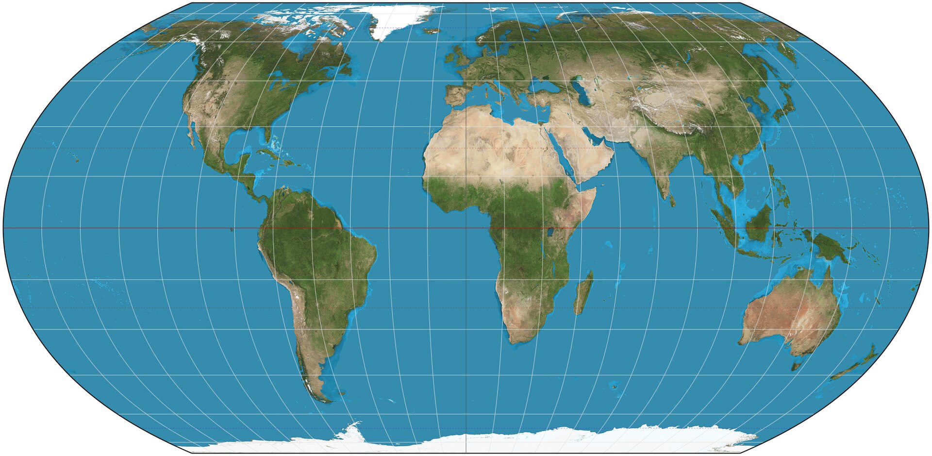
The Equal Earth projection, introduced in 2018, is:
Conformal
Equal-area
Azimuthal
A navigation tool
It is designed to look pleasant and show true sizes.
Image: Strebe, CC BY-SA 4.0, via Wikimedia Commons.
