Quiz · Medium
Meanders, deltas, waterfalls, glacial landforms, coastal erosion, coral reefs and deserts, with photos and satellite images.
On the bend of a meander, where does a river erode most?
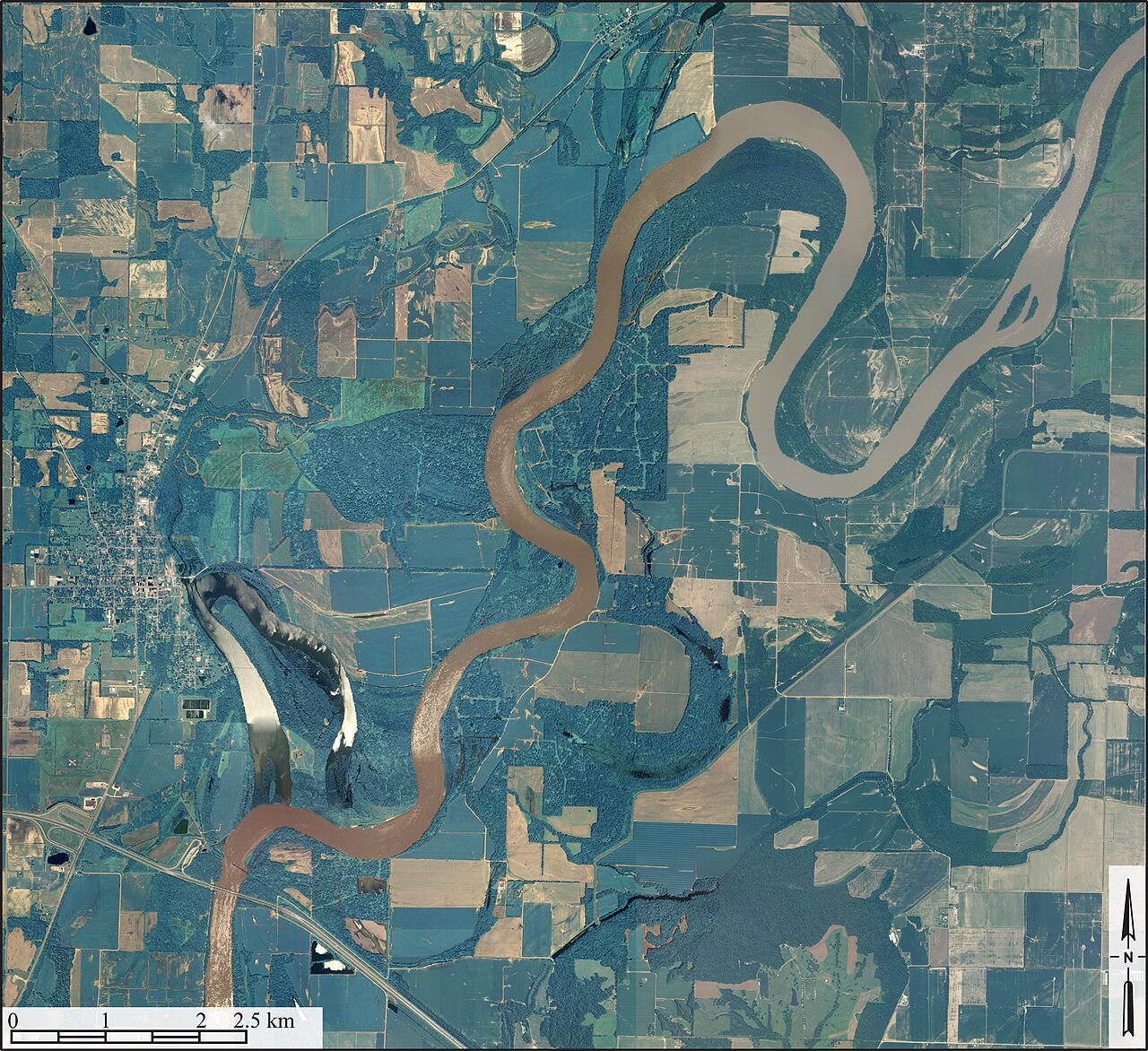
The outside of the bend
The inside of the bend
The middle of the channel only
Equally everywhere
Water flows fastest on the outside of a bend, cutting a steep river cliff. Deposition builds a point bar on the inside.
Image: USDA/FSA, Public domain, via Wikimedia Commons.
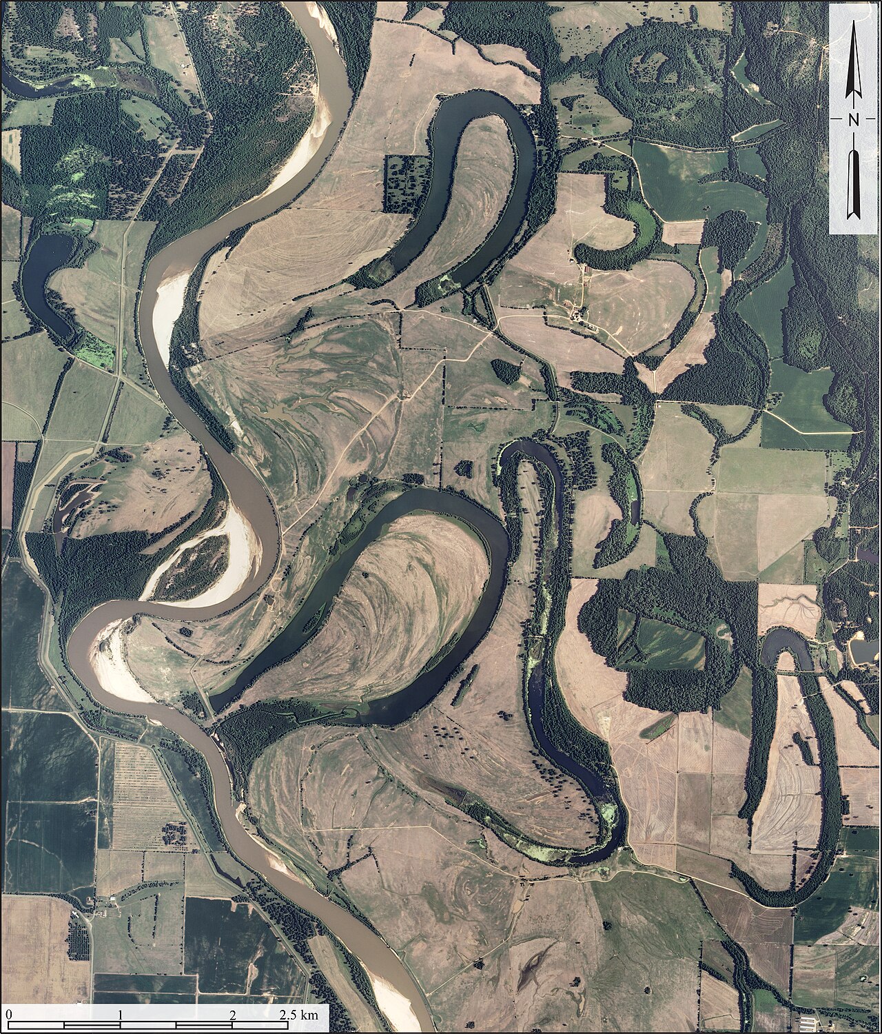
The crescent-shaped lakes beside this river are called:
Kettle lakes
Tarns
Oxbow lakes
Lagoons
They form when a meander neck is cut through and the old loop is sealed off.
Image: USDA/FSA, Public domain, via Wikimedia Commons.
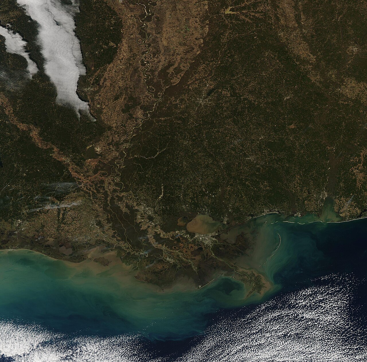
Which type of delta does the Mississippi have?
Arcuate
Cuspate
Estuarine
Bird's-foot
Its long fingers of land extend into the Gulf of Mexico along the river's channels.
Image: Jeff Schmaltz, MODIS Land Rapid Response Team, NASA GSFC, Public domain, via Wikimedia Commons.
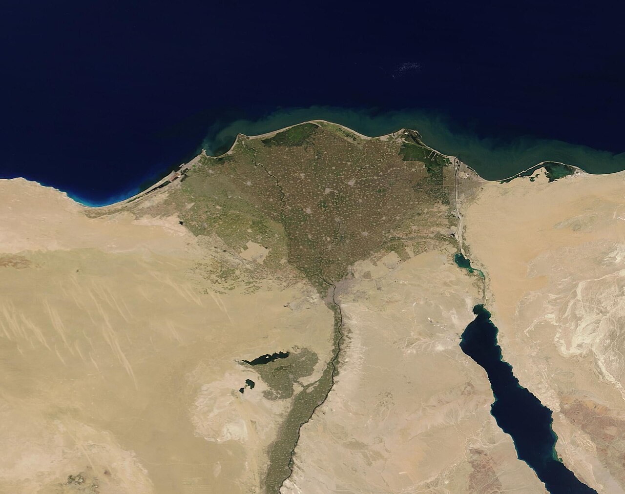
What shape is the Nile Delta?
Bird's-foot
Arcuate (fan-shaped)
Cuspate
Square
The Greek letter delta, a triangle, gave deltas their name.
Image: MODIS Land Rapid Response Team, NASA GSFC, Public domain, via Wikimedia Commons.
The main process that makes a waterfall move upstream is:
Undercutting of soft rock below hard caprock
Wind erosion
Glacial plucking
Longshore drift
The caprock collapses once undercut, so the falls retreat and leave a gorge.
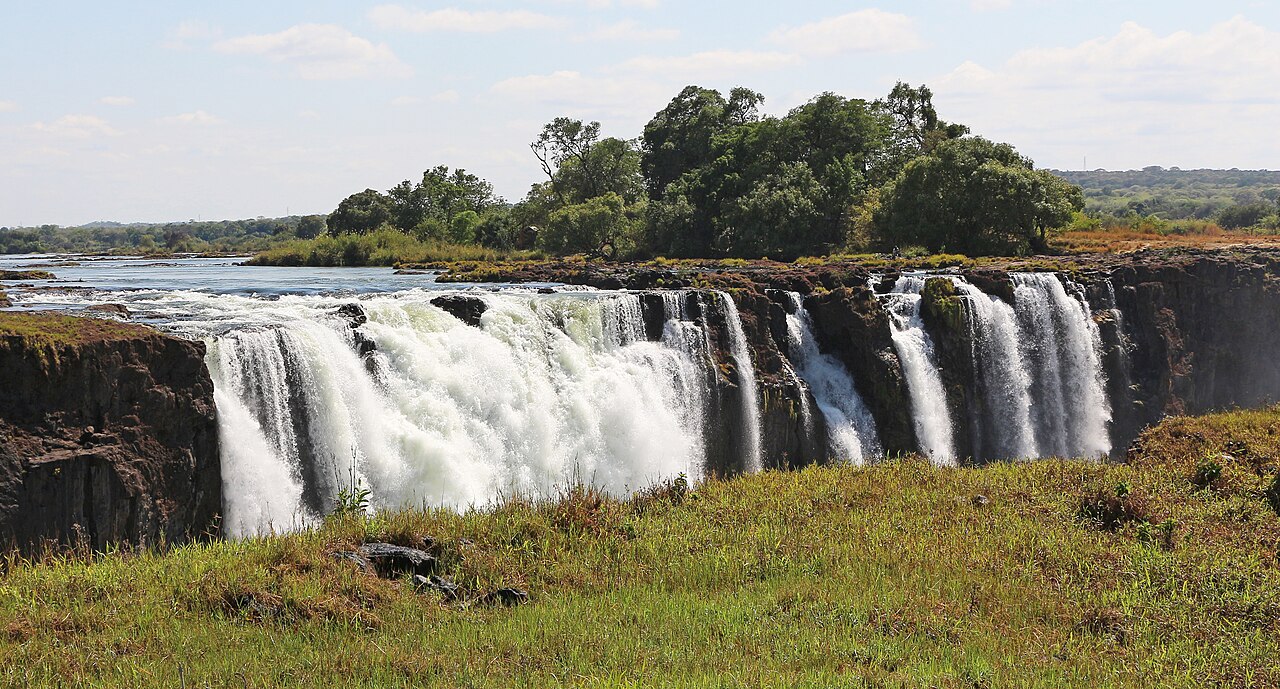
Victoria Falls is on which river?
The Congo
The Nile
The Limpopo
The Zambezi
Its local name, Mosi-oa-Tunya, means 'the smoke that thunders'.
Image: Bernard Gagnon, CC BY-SA 4.0, via Wikimedia Commons.
Which feature is a knife-edge ridge between two cirques?
An arete
A drumlin
An esker
A tarn
Where cirques erode back to back, they leave a sharp arete; where three or more meet, a pyramidal horn.
A drumlin is best described as:
A boulder moved by ice
A winding ridge of meltwater gravel
A smooth, streamlined hill of glacial till
A glacier-filled hollow
The steep end faces the direction the ice came from.
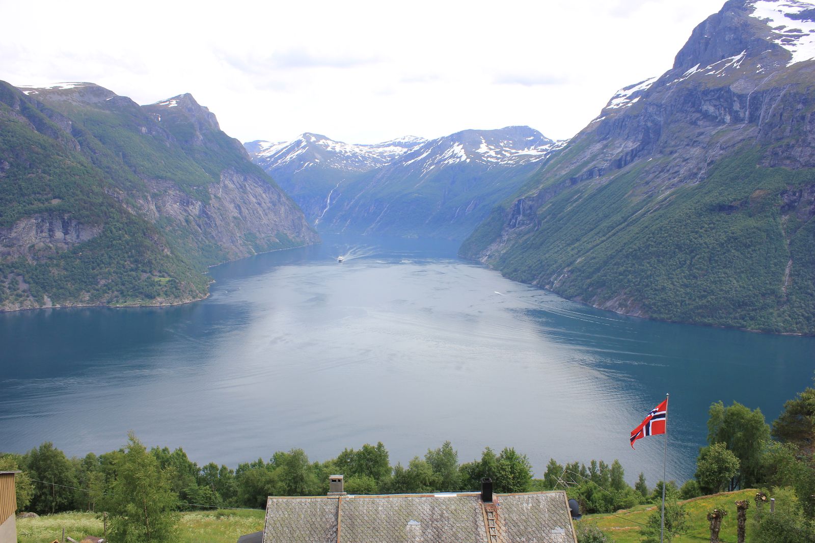
A fjord is:
A drowned river valley
A coral ring around a lagoon
A glacial valley flooded by the sea
A sand ridge joined to the land at one end
A drowned river valley is a ria.
Image: Sundgot, CC BY-SA 4.0, via Wikimedia Commons.
Roughly how much of Earth's fresh water is stored as ice?
About 10%
About 70%
About 30%
About 95%
Most of it is in the Antarctic and Greenland ice sheets.
Put these coastal landforms in order of formation.
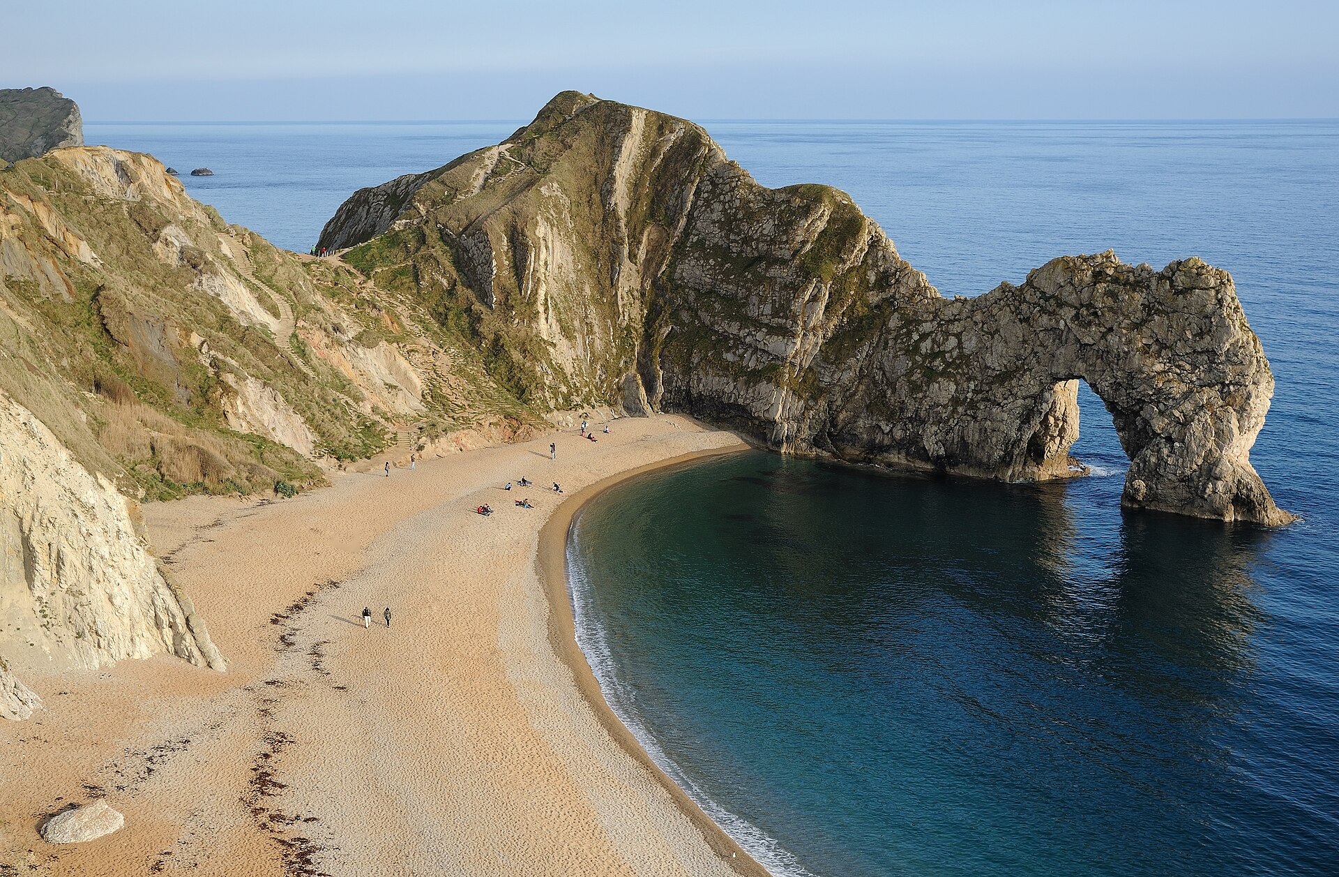
Cave, arch, stack, stump
Stack, stump, cave, arch
Arch, cave, stump, stack
Stump, arch, stack, cave
A headland weakness widens into a cave, then an arch, then a stack when the arch collapses, then a stump.
Image: Saffron Blaze, CC BY-SA 3.0, via Wikimedia Commons.
In longshore drift, sediment moves along the beach in a zigzag because:
Wind blows along the coast
Tides move in a circle
Swash moves diagonally up the beach, but backwash runs straight down
Waves break parallel to the beach
Repeated over time this transports large amounts of sand along the coast.
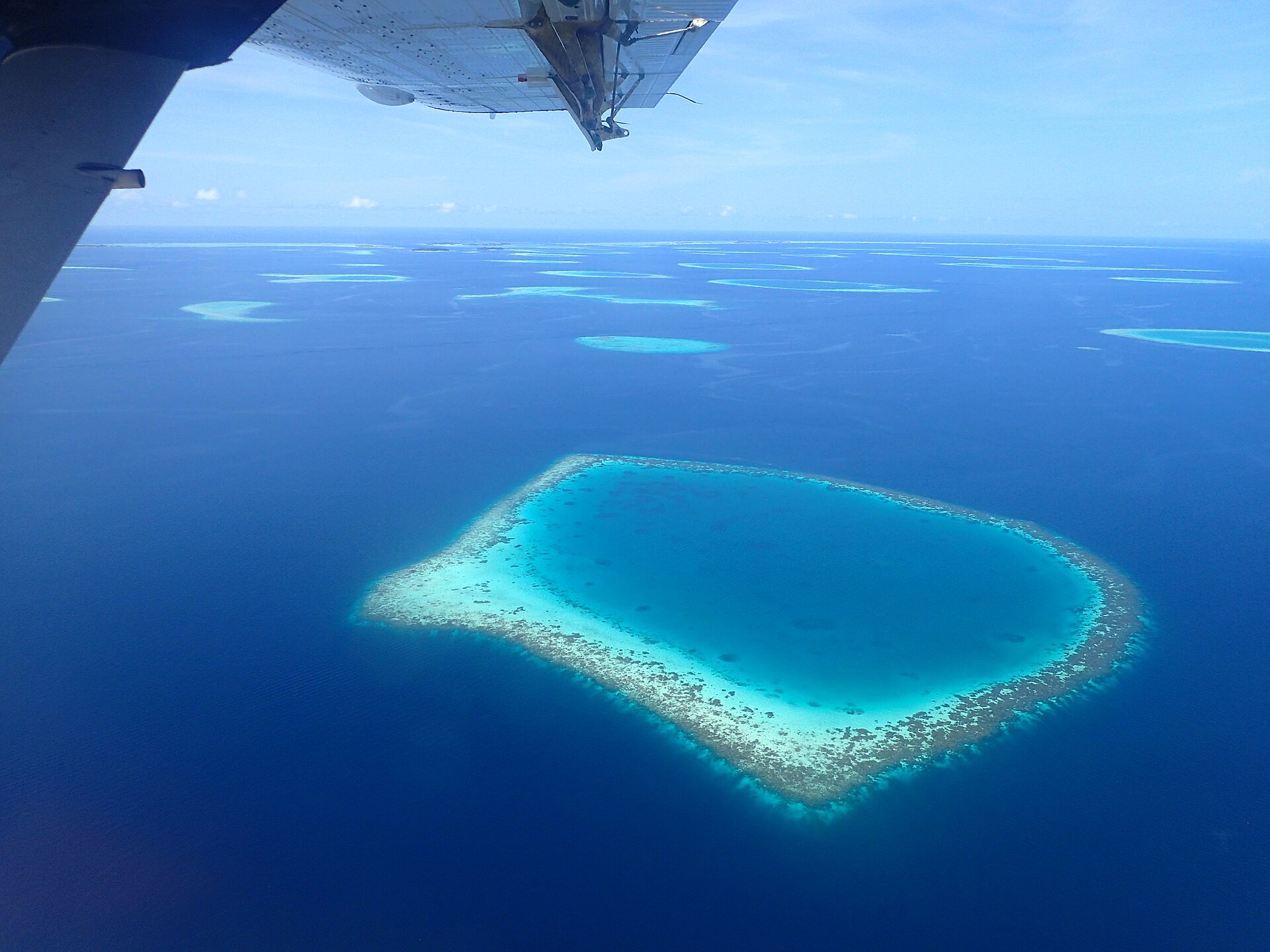
A ring-shaped coral reef surrounding a lagoon is called:
A fringing reef
A barrier reef
An atoll
A cay
Darwin suggested atolls form as a volcanic island sinks while its reef grows upward.
Image: Hotel Kaesong, CC BY-SA 2.0, via Wikimedia Commons.
About how long is the Great Barrier Reef?
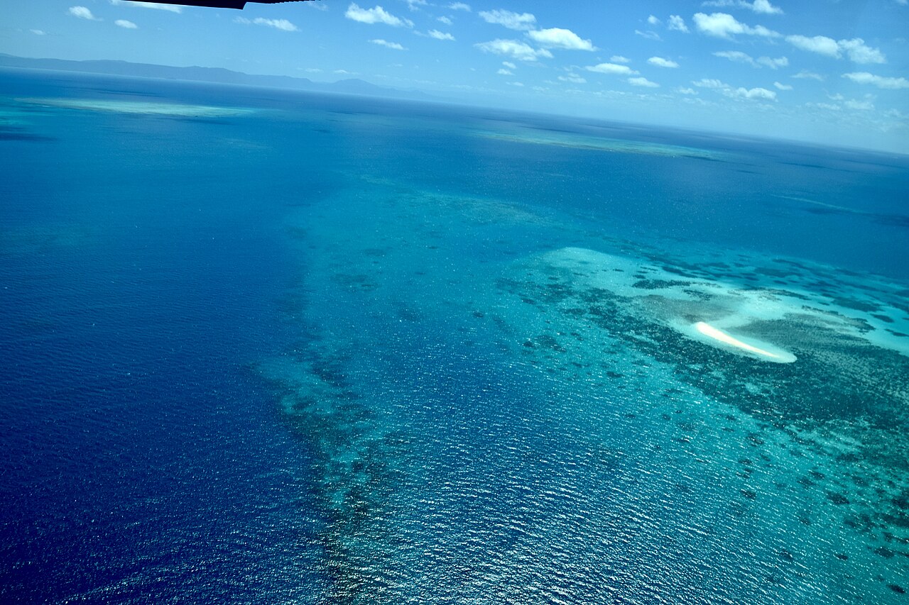
About 230 km
About 850 km
About 2,300 km
About 6,000 km
It stretches along Queensland's coast.
Image: Ank Kumar, CC BY-SA 4.0, via Wikimedia Commons.
An erg is a desert landscape of:
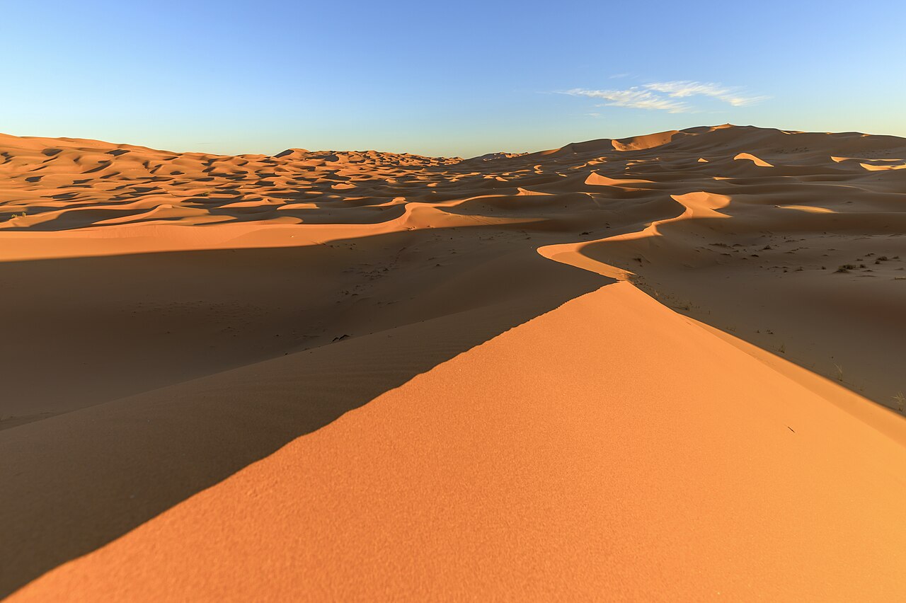
Bare rock
Gravel plains
Salt flats
Sand dunes
Hamada is rocky desert and reg is gravel desert.
Image: Thomas Fuhrmann, CC BY-SA 4.0, via Wikimedia Commons.
Which desert is the driest non-polar desert on Earth?
The Sahara
The Gobi
The Atacama
The Kalahari
The Andes block Atlantic moisture and the cold Humboldt Current suppresses rain.
A crescent-shaped dune with horns pointing downwind is a:
Star dune
Barchan
Linear dune
Parabolic dune
Barchans form in steady winds with limited sand.
The Aral Sea shrank mainly because:
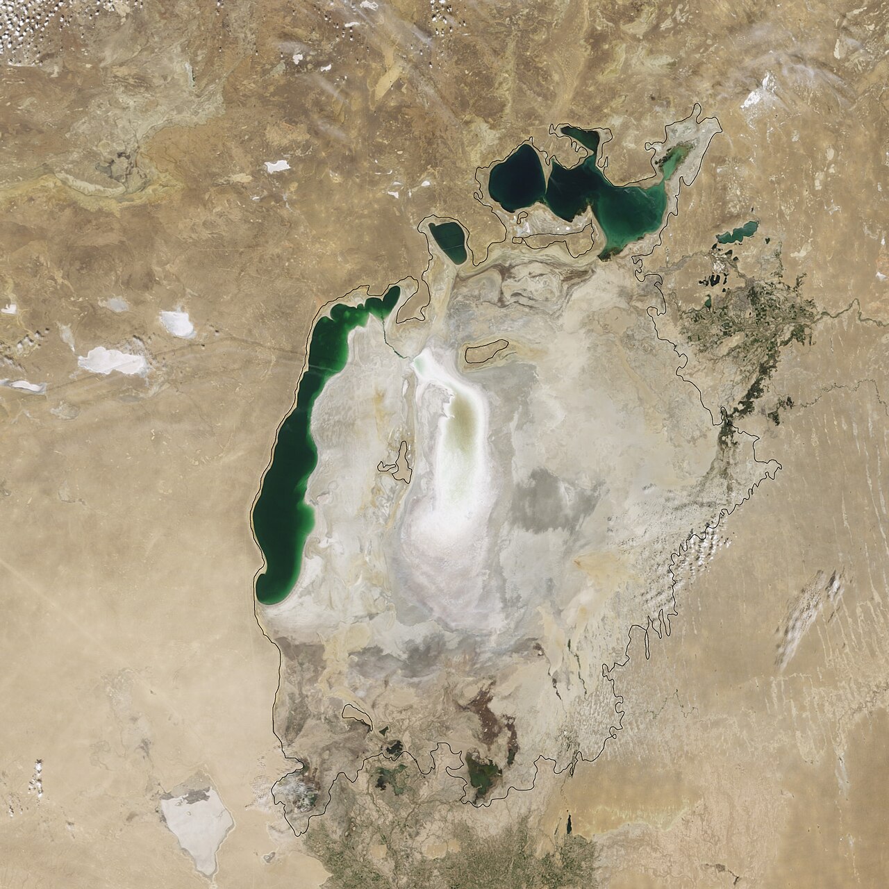
A volcano blocked its outlet
An earthquake drained it
The Caspian Sea captured it
Its feeder rivers were diverted to irrigation
Cotton irrigation in the Soviet Union took the water of the Amu Darya and the Syr Darya.
Image: Jesse Allen, Public domain, via Wikimedia Commons.
About what share of Earth's water is in the oceans?
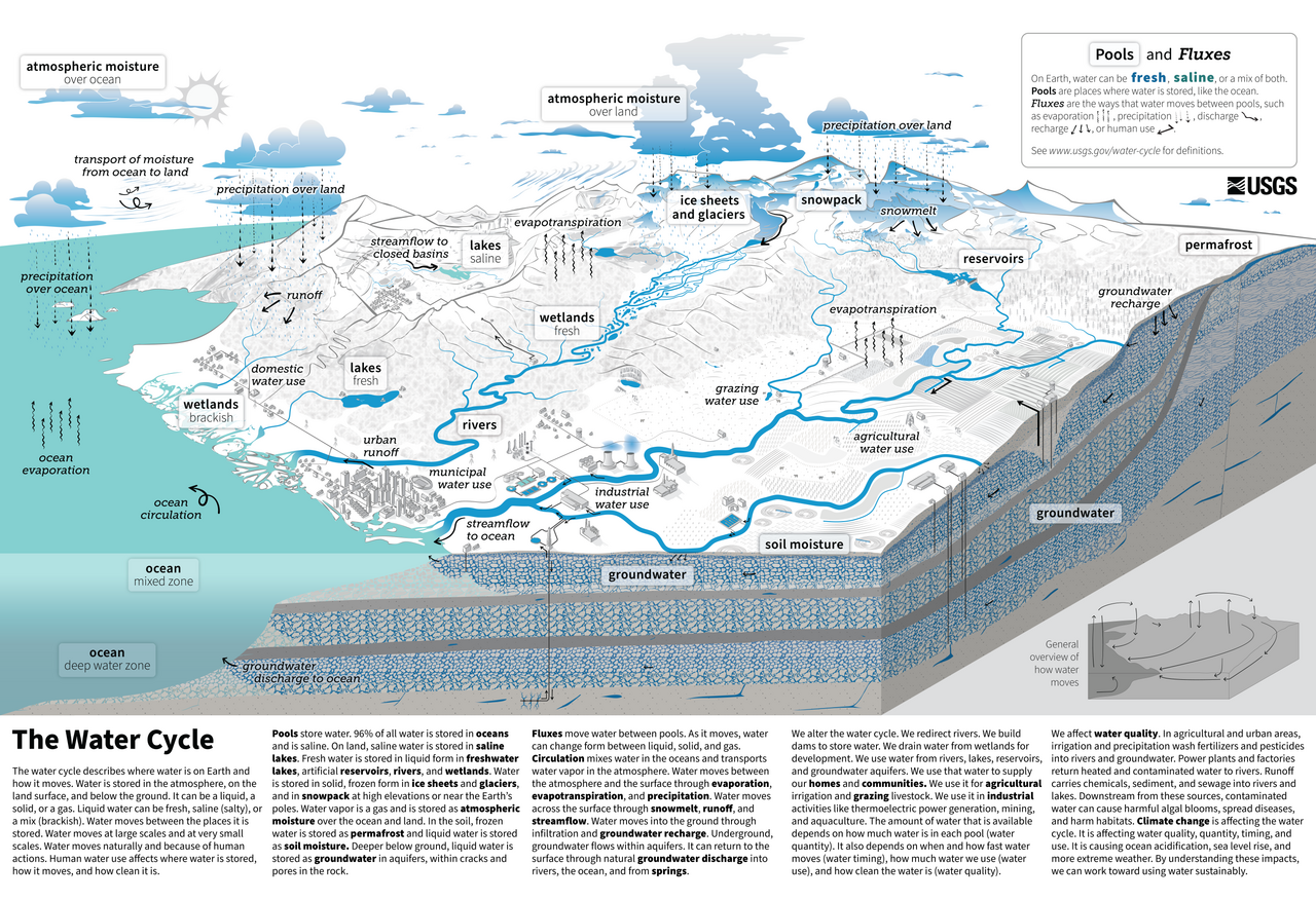
About 71%
About 97%
About 50%
About 85%
About 71% of Earth's surface is ocean, but that is a different statistic from the share of water.
Image: U.S. Geological Survey (Corson-Dosch et al.), Public domain, via Wikimedia Commons.
The Last Glacial Maximum was about:
2,000 years ago
200,000 years ago
2 million years ago
20,000 years ago
Sea level was roughly 120 m lower, so many shallow seas were dry land.
Which glacier ends in a lake in Argentinian Patagonia?
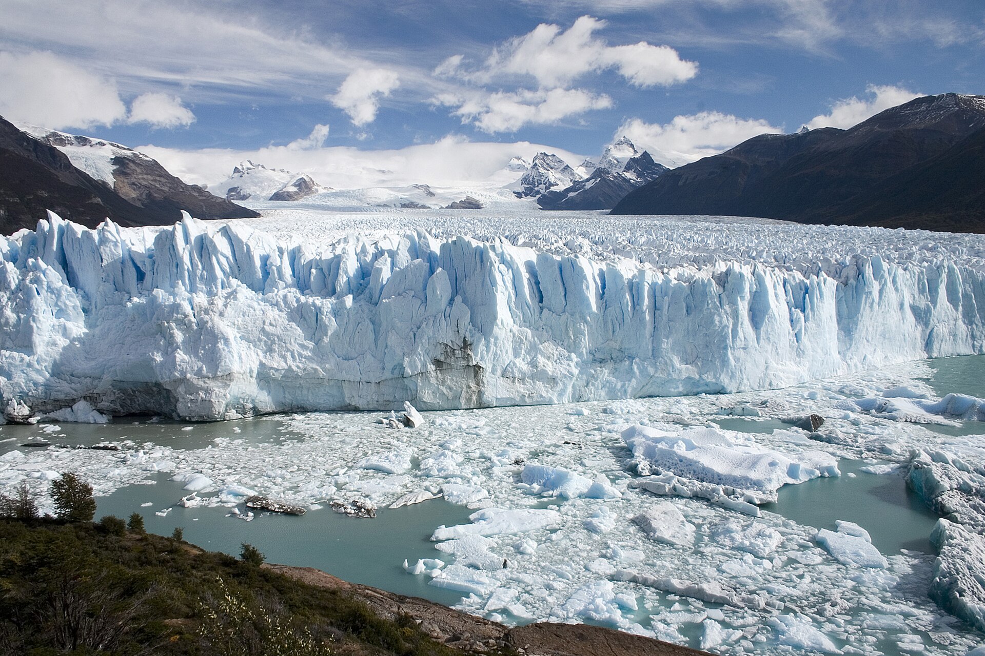
Perito Moreno
Aletsch
Vatnajokull
Columbia
It calves into Lago Argentino in Los Glaciares National Park.
Image: Luca Galuzzi (Lucag), CC BY-SA 2.5, via Wikimedia Commons.
